
Neuerscheinungen 2016 Liste 3421
Stand: 2020-02-01ISBN/Stichwort/Autor
10625 Berlin
Tel.: 030 315 714 16
Fax 030 315 714 14
info@buchspektrum.de
Neuerscheinungen 2016 Liste 3421Stand: 2020-02-01 |
Schnellsuche
ISBN/Stichwort/Autor |
Herderstraße 10 10625 Berlin Tel.: 030 315 714 16 Fax 030 315 714 14 info@buchspektrum.de |

Orange Line.3 7.Kl.Workbook m.CD
Titel: 7. Klasse, Workbook mit Audio-CD
Autor/in:
Frank Haß
1. Auflage. 2016. 96 S. m. Abb. 297 mm
Verlag/Jahr: KLETT 2016
ISBN: 3-12-548283-6 (3125482836)
Neue ISBN: 978-3-12-548283-8 (9783125482838)

Orange Line.3 7.Kl.Workbook+CDA+CDR
Titel: 7. Klasse, Workbook m. Audio-CD u. CD-ROM
Autor/in:
Frank Haß
1. Auflage. 2016. 96 S. m. Abb. 30 cm
Verlag/Jahr: KLETT 2016
ISBN: 3-12-548083-3 (3125480833)
Neue ISBN: 978-3-12-548083-4 (9783125480834)

Orangeriekultur in Oberfranken
Titel: Orangeriekultur in Oberfranken
Autor/in:
Arbeitskreis Orangerien in Deu
Die Fürstentümer Bamberg und Bayreuth
Herausgegeben von Arbeitskreis Orangerien in Deutschland e. V.
2016. 235 S. 152 überwiegend farbige Abbildungen. 23.8 cm
Verlag/Jahr: LUKAS VERLAG 2016
ISBN: 3-86732-250-3 (3867322503)
Neue ISBN: 978-3-86732-250-8 (9783867322508)

Orationen
Titel: Orationen
Autor/in:
Alex Stock
Die Gabengebete im Jahreskreis neu übersetzt und erklärt
Von: Stock, Alex
2016. 104 S. 190 mm
Verlag/Jahr: PUSTET, REGENSBURG 2016
ISBN: 3-7917-2826-1 (3791728261)
Neue ISBN: 978-3-7917-2826-1 (9783791728261)

Orbig:Verwendung elektrolytischer Amalg
Titel: Verwendung elektrolytischer Amalgame zur Reduktion organischer Stoffe
Autor/in:
Heinrig Orbig
Nachdruck der Ausgabe von 1894. 2016. 56 S. 215.9 mm
Verlag/Jahr: HANSEBOOKS 2016
ISBN: 3-7411-1146-5 (3741111465)
Neue ISBN: 978-3-7411-1146-4 (9783741111464)

Orchester der Tiere, m. Tonmodulen
Titel: Orchester der Tiere, m. Soundeffekten
Beteiligte:
Magali Huche, Isabel Kupski, Magali Le Huche
Aus d. Franz. v. Isabel Kupski; Illustr. v. Magali le Huche
4. Aufl. 2016. 24 S. m. zahlr. bunten Bild. 210 mm
Verlag/Jahr: FISCHER SAUERLÄNDER 2016
ISBN: 3-7373-5377-8 (3737353778)
Neue ISBN: 978-3-7373-5377-9 (9783737353779)

Orcutt:Henry Tomlison and his Descendan
Titel: Henry Tomlison and his Descendants in America
Autor/in:
Samuel Orcutt
Nachdruck der Ausgabe von 1891. 2016. 500 S. 215.9 mm
Verlag/Jahr: HANSEBOOKS 2016
ISBN: 3-7428-1057-X (374281057X)
Neue ISBN: 978-3-7428-1057-1 (9783742810571)

Orczy:Le Mouron rouge
Titel: Le Mouron rouge, m. Audio-CD
Autor/in:
Emmuska Baroness Orczy
Französische Lektüre für das 2., 3. und 4. Lernjahr. Niveau B1
2016. 112 S. 211 mm
Verlag/Jahr: KLETT SPRACHEN; CIDEB EDITRICE 2016
ISBN: 3-12-500296-6 (3125002966) / 8853002379 (8853002379)
Neue ISBN: 978-3-12-500296-8 (9783125002968) / 978-8853002372 (9788853002372)

Ord:A Reprint of the North American Zoo
Titel: A Reprint of the North American Zoology
Beteiligte:
William Guthrie, George Ord
Nachdruck der Ausgabe von 1894. 2016. 176 S. 215.9 mm
Verlag/Jahr: HANSEBOOKS 2016
ISBN: 3-7433-3247-7 (3743332477)
Neue ISBN: 978-3-7433-3247-8 (9783743332478)

Ordnance Survey GB Blatt OL092
Titel: Ordnance Survey Active Map Bernard Castle & Richmond
Teesdale. Mobile Download. 1 : 50.000
2016. 227 mm
Verlag/Jahr: ORDNANCE SURVEY 2016
ISBN: 0-319-26190-5 (0319261905) / 0-319-47541-7 (0319475417)
Neue ISBN: 978-0-319-26190-3 (9780319261903) / 978-0-319-47541-6 (9780319475416)

Ordnance Survey Hist.Map Roman Britain
Titel: Ordnance Survey Historical Map Roman Britain
1 : 625.000
2016. 236 x 132 mm
Verlag/Jahr: ORDNANCE SURVEY 2016
ISBN: 0-319-26325-8 (0319263258)
Neue ISBN: 978-0-319-26325-9 (9780319263259)

Ordnance Survey Histor.Map Ancient Brit
Titel: Ordnance Survey Historical Map Ancient Britain
1 : 625.000
2016. 239 x 133 mm
Verlag/Jahr: ORDNANCE SURVEY 2016
ISBN: 0-319-26324-X (031926324X)
Neue ISBN: 978-0-319-26324-2 (9780319263242)
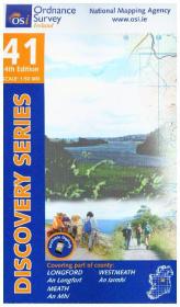
Ordnance Survey Irland Blatt 41
Titel: Ordnance Survey Irland Blatt 41
Discovery. 1 : 50.000
4. Aufl. 2016. 191 mm
Verlag/Jahr: ORDNANCE SURVEY 2016
ISBN: 1-907122-12-5 (1907122125) / 1-908852-63-1 (1908852631)
Neue ISBN: 978-1-907122-12-5 (9781907122125) / 978-1-908852-63-2 (9781908852632)

Ordnance Survey Irland Blatt 42
Titel: Ordnance Survey Irland Blatt 42
Discovery. 1 : 50.000
5. Aufl. 2016. 190 mm
Verlag/Jahr: ORDNANCE SURVEY 2016
ISBN: 1-907122-13-3 (1907122133) / 1-908852-65-8 (1908852658)
Neue ISBN: 978-1-907122-13-2 (9781907122132) / 978-1-908852-65-6 (9781908852656)
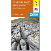
Ordnance Survey Map Yorkshire Dales - S
Titel: Ordnance Survey Map Yorkshire Dales - Southern & Western Area
Whernside, Ingleborough & Pen-y-ghent. 1:25000
2016. 24 cm
Verlag/Jahr: ORDNANCE SURVEY 2016
ISBN: 0-319-24241-2 (0319242412) / 0-319-26331-2 (0319263312)
Neue ISBN: 978-0-319-24241-4 (9780319242414) / 978-0-319-26331-0 (9780319263310)
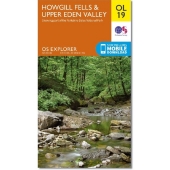
Ordnance Survey MapBl.OL19 Howgill Fell
Titel: Ordnance Survey Active Map Howgill Fells & Upper Eden Valley
Showing part of the Yorkshire Dales National Park. Weatherproof, tearproof. 1 : 25.000
2016. 2 p. 24.5 cm
Verlag/Jahr: ORDNANCE SURVEY 2016
ISBN: 0-319-46937-9 (0319469379) / 0-319-47536-0 (0319475360)
Neue ISBN: 978-0-319-46937-8 (9780319469378) / 978-0-319-47536-2 (9780319475362)
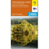
Ordnance Survey MapBl.OL7 English Lakes
Titel: Ordnance Survey Active Map The English Lakes, South-eastern area
Windermere, Kendal & Silverdale. Showing part of the Lake District National Park. Weatherproof, tearproof. 1 : 25.000
2016. 24.5 cm
Verlag/Jahr: ORDNANCE SURVEY 2016
ISBN: 0-319-46925-5 (0319469255) / 0-319-47535-2 (0319475352)
Neue ISBN: 978-0-319-46925-5 (9780319469255) / 978-0-319-47535-5 (9780319475355)

Ordnance Survey.1 Northern Scotland, Or
Titel: Ordnance Survey Maps Straßenkarte Bl.1 Northern Scotland, Orkney & Shetland
1 : 250.000
2016. 1 S. 240 mm
Verlag/Jahr: ORDNANCE SURVEY 2016
ISBN: 0-319-26343-6 (0319263436)
Neue ISBN: 978-0-319-26343-3 (9780319263433)

Ordnance Survey.15North.Ireland Belfast
Titel: Ordnance Survey of Northern Ireland Belfast
Includes Bangor, Mewtownards, Carrickfergus. Area Map with Townland Map on reverse. 1 : 50.000
2016. 2 p. 18 cm
Verlag/Jahr: ORDNANCE SURVEY 2016
ISBN: 1-905306-72-5 (1905306725) / 1-905306-87-3 (1905306873)
Neue ISBN: 978-1-905306-72-5 (9781905306725) / 978-1-905306-87-9 (9781905306879)

Ordnance Survey.2 Western Scotland & th
Titel: Ordnance Survey Maps Straßenkarte Bl.2 Western Scotland & the Western Isles
1 : 250.000
2016. 1 S. 240 mm
Verlag/Jahr: ORDNANCE SURVEY 2016
ISBN: 0-319-26344-4 (0319263444)
Neue ISBN: 978-0-319-26344-0 (9780319263440)
|
zurück |
Hauptliste |
vor |