 Neuerscheinungen 2010Stand: 2020-01-07 |
Schnellsuche
ISBN/Stichwort/Autor
|
Herderstraße 10
10625 Berlin
Tel.: 030 315 714 16
Fax 030 315 714 14
info@buchspektrum.de |

Obinna Anejionu
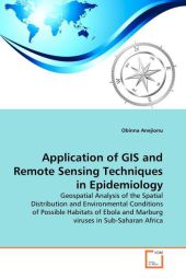
Application of GIS and Remote Sensing Techniques in Epidemiology
Geospatial Analysis of the Spatial Distribution and Environmental Conditions of Possible Habitats of Ebola and Marburg viruses in Sub-Saharan Africa
2010. 204 S. 220 mm
Verlag/Jahr: VDM VERLAG DR. MÜLLER 2010
ISBN: 3-639-25709-X (363925709X)
Neue ISBN: 978-3-639-25709-0 (9783639257090)
Preis und Lieferzeit: Bitte klicken
Viral haemorrhagic fevers have been among the most prominent diseases that have plagued humanity. Among the most notorious of haemorrhagic fevers are Ebola and Marburg, which are two highly infectious and deadly diseases that have appeared sporadically in some parts of Africa, causing many epidemics that have led to the deaths of people and nonhuman primates, in Sub-Saharan Africa. Research is ongoing to identify the natural reservoir of the viruses. Till date, no research has been successful in identifying the natural reservoir of the viruses. This research was carried out to provide a broader knowledge of filoviruses in Africa, by characterising environmental conditions associated with the breeding of the viruses, and subsequently model the distribution of the viruses. Remote sensing and GIS techniques were employed in this research. The result obtained from the various analyses carried out, identified some locations in and outside Africa as possible habitats of filoviruses. It is believed that the results obtained from this research have extended the knowledge in the quest for the identification of the natural reservoir of the two deadly viruses.
Obinna C.D Anejionu studied GIS and Remote at the University of Greenwich London, where he was awarded a Master of Science degree in Geographic Information System with Remote Sensing. He earlier studied at the University of Nigeria Nsukka, where he also works as a lecturer, and obtained a Bachelor of Science degree in Geoinformatics and Surveying


