 Neuerscheinungen 2011Stand: 2020-01-07 |
Schnellsuche
ISBN/Stichwort/Autor
|
Herderstraße 10
10625 Berlin
Tel.: 030 315 714 16
Fax 030 315 714 14
info@buchspektrum.de |

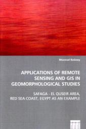
Moawad Badawy
Applications of Remote Sensing and GIS in Geomorphological Studies
Safaga - El Quseir Area, Red Sea Coast, Egypt as anExample
2011. 308 S. 220 mm
Verlag/Jahr: VDM VERLAG DR. MÜLLER 2011
ISBN: 3-639-06068-7 (3639060687)
Neue ISBN: 978-3-639-06068-3 (9783639060683)
Preis und Lieferzeit: Bitte klicken
The present work represents an endeavour of applying
remote sensing and geographic information systems
(GIS) in geomorphological studies. Since the
inception of the Landsat program in the early 1970s,
remote sensing in particular has become an
increasingly important tool for improving
conventional methods of data collection and map
production in geosciences. The potential of using
remote sensing accompanied by GIS in geology and
geomorphology has been long term discussed in the
principal literatures e.g. Lillesand & Kieffer
1977-2000, Drury 1987-2001, Avery & Berlin 1992,
Campell 1996, Easterbrook & Kovanen 1998, Jensen
2000, Sabins 2000, Janssen et al. 2001, Outtara et
al. 2004, and Short 2005. The principal benefits of
using remote sensing and GIS are that the automatic
extraction of information using automatic
classification, band ratioing, quantitative spectral
analysis, easy digital integration with auxiliary
data, and improving mapping and cartographic skills.
Consequently, they are indispensable techniques for
geomorphological and geological studies nowadays.
is a researcher and teacher for physical geography, remotesensing, and GIS in Ain Shams University, Cairo, Egypt. He hasapplied GIS and remote sensing techniques in variety ofenvironmental projects and activities.


