 Neuerscheinungen 2013Stand: 2020-01-07 |
Schnellsuche
ISBN/Stichwort/Autor
|
Herderstraße 10
10625 Berlin
Tel.: 030 315 714 16
Fax 030 315 714 14
info@buchspektrum.de |
Antonis Antoniou, Sven Ehmann, Robert Klanten
(Beteiligte)
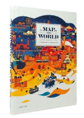
A Map of the World
The World According to Illustrators and Storytellers
Ed.: Antonis Antoniou, E. Klanten and S. Ehmann
3. Aufl. 2013. 224 S. 33 cm
Verlag/Jahr: DIE GESTALTEN VERLAG 2013
ISBN: 3-89955-469-8 (3899554698)
Neue ISBN: 978-3-89955-469-4 (9783899554694)
Preis und Lieferzeit: Bitte klicken
Eine Karte zu zeichnen heißt, die Welt besser zu begreifen. Seit Ewigkeiten nutzen Menschen die Werkzeuge der Kartographie, um ihr Umfeld im Kleinen und die Welt im Großen abzubilden und anderen zu vermitteln. Landkarten zeigen zum einen räumliche Zusammenhänge - Entfernungen, Dimensionen, Topografie - zum anderen aber sind sie immer auch eine Leinwand für unterschiedliche Darstellungsarten, für Illustration, Datenvisualisierung und Visual Storytelling. In Zeiten von Navigationssystemen und Google Maps bekommen diese persönlichen Interpretationen der uns umgebenden Wirklichkeit eine höhere Bedeutung. Gleichzeitig nutzen Zeitschriften, Tourismus und kommerzielle Anbieter diese neuen Karten, um Regionen zu erklären, das lokale Umfeld zu verorten, Stimmungen zu erzeugen und Geschichten zu erzählen.
Eine neue Generation von Designern, Illustratoren und Kartografen entdeckt derzeit ihre Leidenschaft für die verschiedensten Formen de illustrativen Kartografie. A Map of the World zeigt das Spektrum ihrer Arbeiten, von akkuraten und überraschend detailreichen Darstellungen auf der einen, bis zu persönlichen, naiven und modernistischen Illustrationen auf der anderen Seite. Projekte aus aller Welt zeigen die Bandbreite von klassischen, lesbaren Karten und Atlanten, über kartografische Experimente, bis hin zu redaktionellen Illustrationen von Stadtansichten und Weltenbildern.
Karten helfen die Welt zu begreifen und liegen voll im Zeitgeist. Dies ist das Buch der besten, originellsten und gesuchtesten Kartenzeichner.
Maps help us understand the world. This book features the most original and sought-after map illustrators whose work is in line with the zeitgeist. Drawing a map means understanding our world a bit better. For centuries, we have used the tools of cartography to represent both our immediate surroundings and the world at large-and to convey them to others. On the one hand, maps are used to illustrate areal relationships, including distances, dimensions, and topographies. On the other, maps can also serve as projection screens for a variety of display formats, such as illustration, data visualization, and visual storytelling. In our age of satellite navigation systems and Google Maps, personal interpretations of the world around us are becoming more relevant. Publications, the tourism industry, and other commercial parties are using these contemporary, personal maps to showcase specific regions, to characterize local scenes, to generate moods, and to tell stories beyond sheer navigation. A new generation of designers, illustrators, and mapmakers are currently discovering their passion for various forms of illustrative cartography. A Map of the World is a compelling collection of their work-from accurate and surprisingly detailed representations to personal, nave, and modernistic interpretations. The featured projects from around the world range from maps and atlases inspired by classic forms to cartographic experiments and editorial illustrations.