 Neuerscheinungen 2016Stand: 2020-02-01 |
Schnellsuche
ISBN/Stichwort/Autor
|
Herderstraße 10
10625 Berlin
Tel.: 030 315 714 16
Fax 030 315 714 14
info@buchspektrum.de |
George S. Carhart
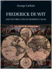
Frederick de Wit and the First Concise Reference Atlas
2016. 592 p. 736 Farbabb. 315.0 mm
Verlag/Jahr: BRILL 2016
ISBN: 9004299033 (9004299033)
Neue ISBN: 978-9004299030 (9789004299030)
Preis und Lieferzeit: Bitte klicken
This book is about the life and work of Frederick de Wit (1629-1706), one of the most famous dealers of maps, prints and art during the Dutch Golden Age, and his contribution to the dissemination of the knowledge of cartography. The Amsterdam firm of Frederick de Wit operated under the name "De Witte Pascaert" (The White Chart) from 1654 to 1710. It offered all kinds of printing and was one of the most successful publishers of maps and prints in the second half of the seventeenth century. The description of De Wit´s life and work is followed by an in-depth analysis and dating of the atlases and maps issued under his name.
Acknowledgments
Introduction
1. Frederick de Wit´s biography and his business
1.1 How many ´Frederick de Wits´
1.2 Johann Gottfried Gregorii (1685-1770)
1.3 Bagrow, Koeman, Van Eeghen and Werner
1.4 A new understanding of De Wit
Tracing Frederick de Wit´s origins
Father and Mother
Why has De Wit been considered to be Catholic?
Hendrick Fredericksz. de Wit´s social standing in Gouda
Education
1.5 De Wit moves to Amsterdam
Why Frederick Hendricksz changed his name to Frederick de Wit
De Wit´s early work
De Drie Crabben 1653-1655
De Witte Pascaert 1655-1710
The St. Lucas guild and De Wit´s membership
De Wit´s real estate ventures
De Wit´s marriage and children
De Wit´s social standing in Amsterdam
1.6 De Wit and the art and print trade
Engraver? Printer? Author? Publisher?
De Wit´s interaction with the engravers and printers in Amsterdam
De Wit´s business contacts outside the Netherlands
De Wit´s interest in current events or topics as shown by his topical prints and maps
De Wit´s trade in cartographic material and art prints from other publishers
1.7 De Wit´s death and Maria´s stewardship of the firm 1706-1710
1.8 1710 the firm is auctioned off
1.9 Conclusion
2. The first modern world atlas
2.1 Defining an atlas
The simple Concise Reference Atlas and complex Encyclopaedic Reference Atlas
The ´Collector´s Composite Atlas´ and the ´Map Sellers Composite Atlas´
2.2 Origins of the atlas
The early atlas
The Netherlands and the first modern Encyclopaedic Atlas
The production of a modern encyclopaedic atlas outside the Netherlands
2.3 Longevity of the first modern atlases
Gerard and Rumoldus Mercator
Cornelis Claesz., Jodocus and Henricus Hondius and Johannes Janssonius.
Competition from Willem Jansz. Blaeu
2.4 The Decline? or Success? of the Dutch hegemony of the map and atlas publishing market in the seventeenth and eighteenth century Europe
French control of the European commercial map and atlas market in the last half of the seventeenth century?
English and German expansion into the commercial map and atlas market of the seventeenth and eighteenth century?
2.5 Pocket atlases
2.6 Conclusion
3. Frederick de Wit´s new Concise Reference Atlas
3.1 A need for an inexpensive and small folio atlas
3.2 De Wit´s first atlases
3.3 Publisher´s or composite atlas
3.4 Who was first? Other contemporary atlas authors and publishers
Nicolaes Visscher
Danckerts
Janssonius Heirs
Nicolas Sanson
3.5 Conclusion
4. Today´s bibliographic methods collide with printing and publishing methods of the early modern world 1577-1800
4.1 Identifying and dating antiquarian maps
Modern Cartobibliographies
Understanding the limitations of the older cartobibliographies
4.2 Shop versus library binding and modern printing and binding practices
Atlas compilation and content
The time aspects of map compilation and intaglio or copper plate engraving
Time management of intaglio printing
Time to print the maps and text for one atlas
Shop binding
´Sold separately´
4.3 Commercial interaction between the map makers of the seventeenth century
Map acquisition
Reprinting of old plates and edits made to them
The significance of having receiving a privilege to print maps
4.4 Conclusion
5. Dating de Wit´s maps and atlases
5.1 Methodology
5.2 Problems with the old cartobibliographies of De Wit´s maps
5.3 New dates for De Wit´s maps and atlases
De Wit´s 1654 sea atlas
De Wit´s first World atlas
De Wit´s Seventeen Provinces atlas
De Wit´s new maps
De Wit expands his small atlas
Janssonius and Blaeu maps as tools for dating De Wit´s atlases
1660 to 1686 and 1686 to 1721
New dates for De Wit´s atlases
Atlas dating through the printed map indexes
5.4 Deluxe maps on silk
5.5 Identifying loose sheet maps by the Janssonius and Blaeu firms that were bound in De Wit´s atlases
5.6 De Wit´s wall maps
De Wit´s elusive world and continental maps
When did De Wit first publish his continental wall ma